
Stanford ESW Tree Trackers
Satellite-Based Reforestation Monitoring for Tropenbos Ghana
Tree Trackers is a reforestation monitoring platform developed through Stanford Engineers for a Sustainable World in collaboration with Tropenbos Ghana. The system combines Sentinel-2 satellite imagery and Google Earth Engine processing with a browser-based dashboard for analyzing vegetation health and change across restoration sites.
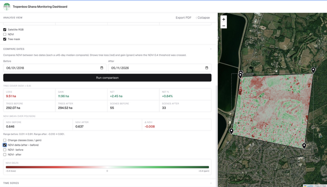
Users can define areas of interest, compare vegetation conditions over time, and review site-level metrics such as NDVI and vegetation coverage. The platform was designed to support scalable monitoring between field visits and help Tropenbos staff assess restoration progress across geographically distributed sites.
The Tree Trackers dashboard is a browser-based interface for monitoring reforestation sites using Sentinel-2 satellite imagery processed in Google Earth Engine. Users can define areas of interest, select analysis dates, visualize NDVI-based vegetation conditions, and review changes in vegetation coverage over time. Built with Next.js and React, the dashboard translates geospatial analysis into a more accessible tool for Tropenbos Ghana staff to remotely assess restoration sites and identify areas that may need closer field investigation.
Live Monitoring Dashboard
Project Development & Updates
The Tree Trackers project page documents how the platform evolved over time, including technical progress, design decisions, and collaboration with Tropenbos Ghana through Stanford Engineers for a Sustainable World.